Showing posts with label Flooding. Show all posts

March 4, 2017

Lessons from Oroville Dam

The evacuation of nearly 200,000 people near Oroville Dam is the kind of event that makes climate change personal. Like many extreme events, the Oroville emergency is a combination of natural weather likely intensified by climate change. 

Dams in the United States were built 50 years ago, on average. Since then, the Earth's surface temperature has warmed about 1.35°F, and there's now more than 5% more water vapor in the atmosphere as a result, which intensifies storms. With hotter temperatures, more precipitation falls as rain and less as snow, and California's Sierra snowpack also melts earlier in the year.

Our infrastructure was designed for yesterday's climate, not today's or tomorrow's. We know the climate is changing and we need to be prepared.

We already see fundamental changes in storm frequency and intensity, increases in the size and duration of droughts and rainfall events, disappearing snow packs, growing agricultural water demands with rising temperatures, and more.
We cannot afford the luxury of pretending climate change isn't real, and we cannot afford to ignore the risks to our water infrastructure posed by these changes. Any investment in infrastructure must take climate change into account through smart flexible design, integration of better weather-forecasting and modeling tools, and adoption of new standards for facility construction and operation.


Environmental groups warned the state about Oroville Dam in 2005, noting that in an intensely wet year like we've seen in 2017, its emergency spillway could erode, and thus should be coated with concrete. State agencies concluded that the cost of this project couldn't be justified given the low probability of such a wet season, but climate change increases the likelihood and intensity of extreme precipitation events.

September 26, 2013

Flooding and Fracking don't mix - see Colorado

Colorado flooding has not only overwhelmed roads and homes, but also the oil and gas infrastructure stationed in one of the most densely drilled areas in the U.S. Nearby locals say an unknown amount of chemicals has leaked, mixing fracking fluids and oil along with sewage, gasoline, and agriculture pesticides.
"You have 100, if not thousands, of wells underwater right now and we have no idea what those wells are leaking," East Boulder County United spokesman Cliff Willmeng said Monday. "It's very clear they are leaking into the floodwaters though."
Photographs shared by East Boulder County United, show many tanks have been ruptured and others floating in the flood. At least one pipeline has been confirmed broken and leaking. [Climate Progress]

December 29, 2012

Old-Timer Schools Everyone With Poignant Flood Photos

Gideon Mendel doesn't have a Facebook account. He "never really found a voice on Twitter" and his website doesn't have a bio. 

But his use of Instagram to cover the Nigerian floods that were being largely overlooked by (American) media – the worst in the country for 50 years that killed 363 people, injured over 18,000 and displaced more than 2 million – has been brilliant, and a testament to the power of images speaking for themselves.

Click the link above to see his photos. 

December 5, 2012

Nuclear Reactors and Dams

Whistleblowers accuse NRC of inaction in the face of potentially catastrophic flood risks at nuclear plants that sit downstream from large dams.
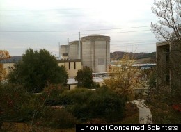
The Oconee Nuclear Station in South Carolina

David Lochbaum, a nuclear engineer and safety advocate with the Union of Concerned Scientists, a Cambridge, Mass.-based advocacy group, calculated that the 34 reactors highlighted in Perkins's analysis are downstream from a total of more than 50 dams -- half of them roughly the size of the Jocassee Dam. "Assuming the NRC's failure rate applies to all of those dams," Lochbaum noted in an 
analysis posted to the group's web site, "the probability that one will fail in the next 40 years is roughly 25 percent -- a 1 in 4 chance."


Taken together, the documents and charges shed new light on an agency that has been repeatedly criticized for allowing plant owners to delay crucial safety improvements for years, and for diligently withholding information not as a way of protecting the public interest, but as a way of protecting itself.

June 27, 2012

Floods and Wildfires

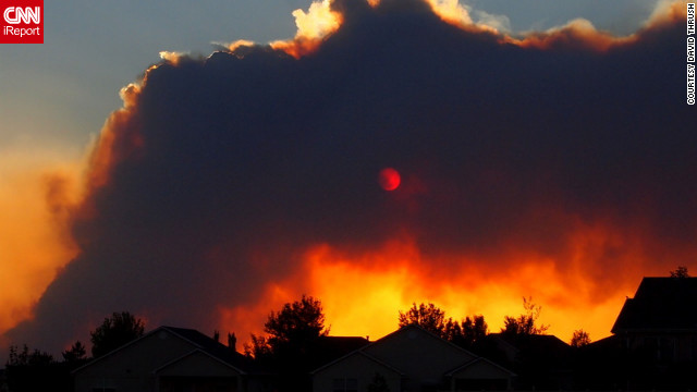
Firefighters again will battle inferno-like conditions on Wednesday as they try to tame an explosive wildfire that has already chased some 32,000 residents from their homes near Colorado Springs, Colorado. [CNN]

Vacation homes and commercial properties in flood-prone areas could see their flood-insurance premiums more than double over a four-year period under a bill poised to clear the Senate this week. [Wall Street Journal]

May 14, 2011

Farmland flooded to protect cities

LAKE PROVIDENCE, La. — The Boston Globe reports that in an agonizing trade-off, Army engineers said they will open a key spillway along the bulging Mississippi River as early as today and inundate thousands of homes and farms in Louisiana's Cajun country to avert a potentially bigger disaster in Baton Rouge and New Orleans.


About 25,000 people and 11,000 structures could be in harm's way when the gates on the Morganza spillway are unlocked for the first time in 38 years.

Opening the spillway will release a torrent that could submerge about 3,000 square miles under as much as 25 feet of water but would take the pressure off the downstream levees protecting New Orleans, Baton Rouge, and the numerous oil refineries and chemical plants along the lower reaches of the Mississippi.

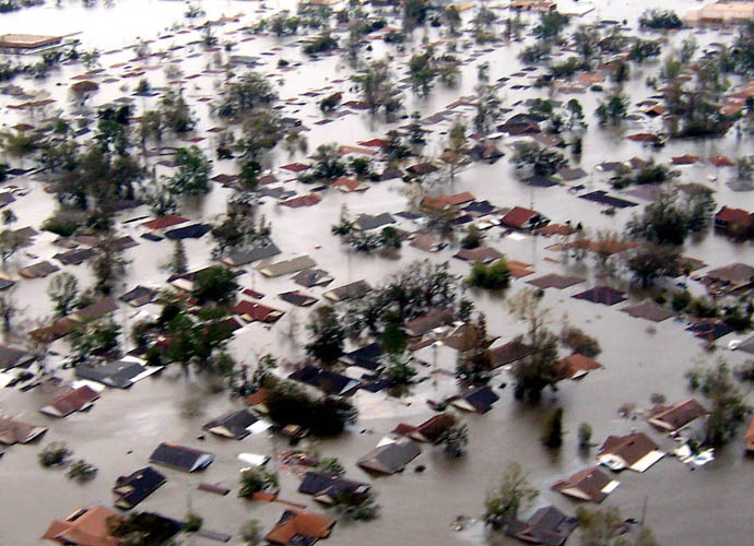
Engineers feared that weeks of pressure on the levees could cause them to fail, swamping New Orleans under as much as 20 feet of water in a disaster that would have been much worse than Hurricane Katrina in 2005.

Instead, the water will flow 20 miles south into the Atchafalaya River. From there it will roll on to the Gulf of Mexico, flooding swamps and croplands. Morgan City, an oil-and-seafood hub and a community of 12,000, shored up levees as a precaution.

The Army Corps of Engineers said it will open the gates when the river's flow rate reaches a certain point, expected today. But some people living in the threatened stretch of countryside — an area known for small farms, fish camps, and a drawling French dialect — have already started fleeing for higher ground.

Sheriffs and National Guard members will warn people in a door-to-door sweep through the area, Governor Bobby Jindal said. Shelters are ready to accept up to 4,800 evacuees, the governor said.
"Now's the time to evacuate,'' Jindal said. "Now's the time for our people to execute their plans. That water's coming.''

The corps employed a similar cities-first strategy earlier this month when it blew up a levee in Missouri — inundating an estimated 200 square miles of farmland and damaging or destroying about 100 homes — to take the pressure off the levees protecting the town of Cairo, Ill., population 2,800.

With crop prices soaring, farmers along the lower Mississippi had been expecting a big year. But now many are facing ruin, with floodwaters swallowing up corn, cotton, rice, and soybean fields.
In far northeastern Louisiana, Tap Parker and about 50 other farmers filled and stacked massive sandbags along an old levee to no avail.

The Mississippi flowed over the top Thursday, and nearly 19 square miles of soybeans and corn, known in the industry as "green gold,'' was lost.

"This was supposed to be our good year. We had a chance to really catch up. Now we're scrambling to break even,'' said Parker, who has been farming since 1985.


February 7, 2011

Floods in your future?


Governor Patrick told us back in March that the flooding we experienced in the greater Boston area was the result of “two 50-year storms in the course of two or three weeks.” Standard probability analysis would suggest that the likelihood of experiencing two 50-year storms a couple weeks apart would be a once in 2,500 year event.  Does that mean we can relax and go back to business as usual? 

Perhaps the local weather records can shed some light on that question. The weather records from Hanscom Air Force Base since 1957 show that during the period from 1957 to 1990, we had only one day with more than 4 inches of rain (that was in 1962). 

Since 1990 we've had 7 days with 4 inches or more of rain. That means that over the last 20 years Lexington has been 12 times as likely to experience an extreme precipitation event or a superstorm, compared to the previous 30 years of data. 

The two storms we had in March of 2010 dumped 25% of our total annual rainfall on us in just 7 days, including one day when we had 4.3 inches of rain. That works out to 13 times more rain than the 7 day average. 

As we learned in March, our storm water drainage systems haven’t been designed to accommodate these increasingly frequent storms that can dump over 10% of our annual precipitation on us in one day. The consequences of intense storms directly affect our lives, causing flooding in our basements, inundating our storm water system, incurring emergency response costs and even disrupting our water supply. 

You may be surprised to learn that the increased frequency of intense storms is the direct result of a warmer climate. As the climate warms, the warmer air in our atmosphere holds more moisture. Scientists calculate that the 1 degree of warming that has already occurred causes an increase in the amount of water vapor in the air of 4%.  

A 4% increase in atmospheric water vapor over the US is the equivalent to adding all the water from Lake Superior to the air over the US. And what goes up must come down. And when it does come down, that precipitation is coming down in increasingly intense superstorms - which can cause devastating floods. 

Extreme flooding events aren’t only confined to the area surrounding Lexington. One of the primary effects of global warming has been to increase the frequency of intense storms and extreme flooding events around the world.

In the last twelve months we've seen the worst flooding on record for Pakistan, Tennessee, Brazil, Columbia, Australia, and now Sri Lanka. Pakistan still has millions who are homeless. Australia has an area the size of Texas under water. Flooding two weeks ago has resulted in over 665 dead in Brazil and over 300,000 homeless in Sri Lanka. 

So what does this mean for Lexington, Massachusetts? Unfortunately the answer is more flooding. 

The weather patterns in Lexington have changed dramatically in the last 20 years. It is time to begin planning to address these changes if we are to ensure that we have the proper infrastructure and systems in place to deal with this new reality.